On Friday, I parked at the Dahlgren Chapel parking lot and headed south towards Bear Spring Cabin. This would be a 12-mile hike total. At this point crossing Old National Pike at Dahlgren Chapel will represent the 24-mile mark of the Maryland Challenge. The most important feature of this stretch is the climb up Lambs Knoll.
Lambs Knoll represents the last significant climb of the Maryland Challenge, with an elevation gain of 700 feet in just less than 2 miles. For me this climb was not too difficult, the trail is well marked and there are few if any obstacles. However, I imagine this to be a different story when we arrive here in June having completed 24 miles of hiking. The top of Lambs Knoll has three communication towers, which were obscured by morning fog. Additionally, there are some rock outcroppings, which on a clear day would provide a nice view of the valley below.
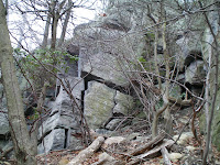
At the bottom of the White Rocks
Today, I decided to take the White Rock Trail to Bear Spring Cabin. The trail is relatively steep as it descends Lambs Knoll toward Mountain Church Road. Bear Spring Cabin sets at 900 feet of elevation and the trail is just over 1 mile in length. Unlike the Appalachian Trail, the White Rock Trail is less traveled and there was a large amount of leaves and debris scattered across the trail. If it were not for the blue blazes I probably could not recognize the trail itself. It took about 20 minutes to make my way to the cabin, a rustic looking building with a small campground. The area looked like it had not been used in awhile. I took pictures and made my way up the trail, this time it took some time to make it back to the top and catch the Appalachian Trail.
Bear Spring Cabin
This area is also significant for the battle of South Mountain, a Civil War battle fought in September of 1862. There is a monument to fallen Union General Jesse Reno along the trail. This area of South Mountain was a major thoroughfare during the 1860s and it was seen as a strategic advantage to have control of the mountain passes.
Reno Monument
The hike was another success, and I am feeling prepared for the 40 miler in June. I will try and up the mileage this month to get ready for the all day hike.
Monday, April 14, 2008
Saturday, April 12, 2008
Out and Back I-70 Footbridge to Ensign Cowall Shelter (18miles)
Matt and I decided this route would help us gauge our fitness levels as it is just under 20 miles and therefore as if doing half the Maryland Challenge. Since the route we are taking will be Southbound, I will start with us reaching Ensign Cowall Shelter and hiking towards the I-70 Footbridge. Which is good, as we had just descended down to Wolfsville Rd, sadly realizing we would be climbing up that same hill. Ensign Cowall shelter lies 10 miles from the border of Pennsylvania along the Appalachian Trail. At this point of our journey we will be a quarter of the way done, and about to ascend up South Mountain to the Annapolis Rocks. The shelter is right along Wolfsville Rd and has all the comforts of trail hiking – an outhouse, a spring, campsites, and a nice lean to. We rested here for a brief period before beginning our climb back up the mountain.
In front of the Ensign Cowall Shelter
There is a 300-foot elevation change from the shelter to the South Mountain ridgeline, although not difficult this portion of the trail is very rocky, and your progress is slowed trying to navigate through the rocks. The next three miles were typical ridgeline hiking with a few small ups and downs but nothing significant. Finally, after hiking the ridgeline for 6 miles we made it to Annapolis Rocks.
Matt traveling some of the rocky parts of the trail
Annapolis Rocks is Maryland’s premier spot along the Appalachian Trail, and is visited frequently from hikers and rock climbers. The hike from the US-40 parking lot to Annapolis Rock is about 2 miles, which makes a good hike for the average day hiker who has spent the winter indoors. This was the case today, as there were 20-30 people along the rocks. The rocks themselves are steep cliffs, which face west towards Hagerstown. The view today was nice. Our thoughts were we would not be stopping when we hike past the rocks on our Maryland Challenge, therefore now was the time to take in the views.
View from Annapolis Rocks
After the Annapolis Rocks, the trail flattens out again. The portion of the trail from Annapolis Rock to the I-70 footbridge is well traveled, and there are few if any rocks on this portion. The trail itself widens out and becomes almost a highway going through South Mountain.
Subscribe to:
Posts (Atom)